Mountain Climbing in Uganda
Unleash Your Adventurous Spirit with Outback Adventure Safaris
Mountain climbing in Uganda is a one-of-a-kind experience, where breathtaking landscapes, rich biodiversity, and cultural immersion converge to create an unforgettable adventure. Whether you’re a seasoned mountaineer or a passionate explorer looking to challenge yourself, Uganda’s majestic mountains offer an incredible variety of climbs that are as rewarding as they are awe-inspiring. From the snowcapped peaks of the Rwenzori Mountains to the volcanic summits of the Virungas and the untamed beauty of Karamoja’s ranges, Outback Adventure Safaris invites you to experience the best of Uganda’s highlands.
Conquer the Rwenzori Mountains – The Mountains of the Moon
Towering along the western border with the Democratic Republic of Congo, the Rwenzori Mountains are Africa’s third-highest mountain range and the crown jewel of mountain climbing in Uganda.

Successful climbers celebrate at Margherita Peak (5,109m) on Mount Stanley in the Rwenzori Mountains, the highest point in Uganda and one of Africa’s most rewarding mountain climbing adventures.
Mt. Stanley, the highest peak, soars to an elevation of 5,109 meters and is capped with dramatic glaciers—a rare sight so close to the equator.
The Rwenzoris are not only known for their elevation but also for their surreal landscapes. Think ancient forests, cascading waterfalls, alpine meadows, and endemic wildlife found nowhere else on Earth. Whether you’re a hiker, nature lover, or serious climber, this UNESCO World Heritage Site offers world-class trekking routes:
-
The Central Circuit Trail – This classic route offers a 7–9 day loop through lush valleys and high-altitude passes. It’s ideal for climbers aiming to summit Margherita Peak.
-
Kilembe Trail – Managed by Rwenzori Trekking Services (RTS), this trail offers more solitude and striking views, following the Nyamwamba River Valley and providing an equally scenic route to the summit.
-
Southern Circuit Trail – The most challenging and remote route, perfect for experienced climbers seeking a deeper adventure through the Mubuku and Bujuku valleys.
⛰️ Ready to climb the Mountains of the Moon? Book your Rwenzori expedition today with Outback Adventure Safaris and let us guide you to the roof of Uganda!
Climbing Mount Elgon – The Gentle Giant of the East
Located in eastern Uganda along the Kenyan border, Mount Elgon is an extinct volcano with the largest caldera in the world. Though less demanding than the Rwenzoris, Elgon’s beauty lies in its scenic variety—misty forests, bamboo groves, open moorlands, and hidden caves etched into the landscape.
During your trek, you’ll encounter unique wildlife such as colobus monkeys, duikers, and a wide variety of bird species. There are two main trails:
-
Sasa Trail (Budadiri Trailhead) – The shortest and most direct route to the summit.
-
Piswa Trail – A more gradual ascent, ideal for bird watchers and nature lovers.
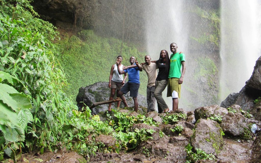
The journey is enriched by side excursions to Sipi Falls, a trio of stunning waterfalls nestled in Elgon’s foothills. These falls offer incredible day hikes and refreshing breaks for those exploring the region.
🌄 Discover Uganda’s serene side on a Mount Elgon hike. Contact Outback Adventure Safaris to customize your trek today!
Hike the Virunga Volcanoes in Mgahinga Gorilla National Park
For those craving a true volcanic adventure, mountain climbing in Uganda reaches new heights in the Virunga Mountains.
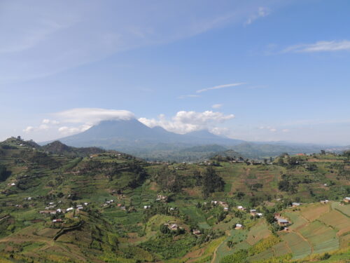
Located in the far southwest, on the tri-border with Rwanda and the DRC, this chain of extinct volcanoes is a thrilling part of Uganda’s climbing circuit.
You can conquer three incredible volcanoes from the Ugandan side:
-
Mount Muhavura (4,127m) – The most challenging and rewarding climb with panoramic views that stretch into Rwanda and the DRC.
-
Mount Gahinga (3,474m) – A gentle climb through bamboo forests, perfect for beginners or as a warm-up for more intense hikes.
-
Mount Sabinyo (3,645m) – Known for its dramatic, rugged trail that lets you stand in three countries at once!
Climbing starts from the Ntebeko Visitor Center at 7:30 AM daily. Make sure to bring energy snacks, lunch, and plenty of water. Trekking permits cost USD 95, which includes park entrance and guide fees.
🔥 Add an epic volcano climb to your gorilla trekking adventure. Book a customized Virunga volcano tour with Outback Adventure Safaris today!
Explore the Untamed Mountains of Karamoja
Off the beaten path, Karamoja offers raw and unspoiled mountain climbing in Uganda. This remote region in northeastern Uganda is home to rugged landscapes, rich indigenous culture, and epic climbs:
-
Mount Kadam (3,063m) – A 2–3-day trek through remote villages and striking rock formations. Starts at Nakapiripirit and offers a blend of challenge and culture.
-
Mount Napak – The most demanding of Karamoja’s peaks, ideal for multi-day expeditions with steep climbs and lush greenery.
-
Mount Morungole (2,750m) – Known as the spiritual heartland of the Ik people, this day hike offers panoramic views and deep cultural significance.
This region is ideal for intrepid travelers looking for a cultural and physical adventure. Treks here often involve interactions with local communities like the Tepeth, Pokot, and Kadam tribes, adding an enriching layer to the experience.
🌍 Step off the tourist trail—climb the sacred peaks of Karamoja with Outback Adventure Safaris and uncover Uganda’s wildest corners.
Why Choose Outback Adventure Safaris?
At Outback Adventure Safaris, we don’t just offer mountain climbing in Uganda—we deliver once-in-a-lifetime journeys. Our expert guides, personalized itineraries, and commitment to sustainable tourism ensure every climb is safe, memorable, and deeply rewarding.
✅ Tailor-made trekking packages
✅ Professional, experienced mountain guides
✅ All logistics handled—permits, gear, transport, and lodging
✅ Authentic cultural experiences with local communities
Book Your Mountain Climbing Adventure in Uganda Today!
Whether you dream of scaling the glacial peaks of the Rwenzoris, exploring volcanic giants in Mgahinga, or immersing yourself in Karamoja’s wild highlands, Outback Adventure Safaris is your perfect partner.
🎒 Ready to rise above the clouds? Get in touch today to start planning your unforgettable mountain climbing experience in Uganda!
📞 Contact us now | ✉️ Inquire for a quote | 🌐 Book your trip online
What are the best mountains to climb in Uganda?
Uganda offers several exciting mountain climbing destinations suitable for both beginner hikers and experienced mountaineers. The most popular mountains include:
-
Rwenzori Mountains National Park – home to Africa’s third-highest peak and the most challenging climb in Uganda.
-
Mount Elgon National Park – a gentler climb with scenic trails and the world’s largest volcanic caldera.
-
Mgahinga Gorilla National Park – features three volcanic peaks: Mount Sabinyo, Mount Gahinga, and Mount Muhabura.
-
Mount Moroto and Mount Kadam in the Karamoja region for adventurous and less-crowded hikes.
Each mountain offers unique landscapes, wildlife, and cultural experiences.
How difficult is mountain climbing in Uganda?
The difficulty varies depending on the mountain and the route chosen.
-
The Rwenzori Mountains are considered the most challenging climb in Uganda, involving multi-day treks, high altitude, and technical sections near the summit.
-
Mount Elgon offers a moderate trekking experience suitable for most physically fit travelers.
-
Volcano hikes in Mgahinga Gorilla National Park are shorter and can be completed in a single day.
The highest peak in Uganda is Margherita Peak on Mount Stanley, which rises to about 5,109 meters above sea level.
How long does it take to climb the Rwenzori Mountains?
A typical trek to the summit of Margherita Peak in the Rwenzori Mountains takes 7 to 10 days, depending on the route and acclimatization schedule. The most popular routes include the Central Circuit Trail and the Kilembe Trail, which pass through forests, alpine valleys, and glacier zones.
Shorter trekking options of 3 to 5 days are also available for hikers who do not plan to summit the highest peaks.
How many days does it take to hike Mount Elgon?
Mount Elgon treks typically take 4 to 7 days, depending on the trail used and the pace of the climbers. The mountain’s highest point is Wagagai Peak (4,321 meters).
Popular Mount Elgon hiking routes include:
-
Sasa Trail
-
Piswa Trail
-
Sipi Trail
Each route passes through forests, caves, waterfalls, and high-altitude moorlands.
What is the best time to go mountain climbing in Uganda?
The best time for mountain climbing in Uganda is during the dry seasons, when trails are less muddy and visibility is better.
Best months for climbing:
-
June to August
-
December to February
These months generally offer clearer skies and more stable hiking conditions.
Do you need a guide to climb mountains in Uganda?
Yes. Most mountains in Uganda require climbers to be accompanied by licensed guides and park rangers. This is particularly important in national parks like:
-
Rwenzori Mountains National Park
-
Mount Elgon National Park
-
Mgahinga Gorilla National Park
Guides ensure safety, help navigate the trails, and provide valuable knowledge about wildlife and the environment.
What should I pack for mountain climbing in Uganda?
Essential gear for mountain climbing in Uganda includes:
-
Waterproof hiking boots
-
Warm layers and thermal clothing
-
Rain jacket and poncho
-
Gloves and hat
-
Backpack
-
Trekking poles
-
Headlamp or flashlight
-
Reusable water bottle
For high-altitude climbs like the Rwenzori, technical gear such as crampons and ice axes may also be required.
Can beginners climb mountains in Uganda?
Yes. Uganda offers mountain climbing opportunities for both beginners and experienced hikers.
-
Beginners can hike Mount Elgon or the volcanic mountains in Mgahinga Gorilla National Park.
-
Experienced climbers seeking a serious challenge can attempt the Rwenzori Mountains, which include glaciers and technical summit sections.
Is mountain climbing in Uganda safe?
Yes, mountain climbing in Uganda is generally safe when organized through licensed tour operators. Climbers are accompanied by professional guides, porters, and park rangers who are trained to manage mountain conditions and emergencies.
Travelers are advised to:
-
Book through reputable tour companies
-
Follow guide instructions
-
Allow time for acclimatization on high mountains
Can mountain climbing be combined with other safari activities?
Absolutely. Many travelers combine mountain climbing with other safari experiences, such as:
-
Gorilla trekking in Bwindi Impenetrable National Park
-
Wildlife safaris in Queen Elizabeth National Park
-
Chimpanzee tracking in Kibale National Park
-
Bird watching and cultural tours
This makes Uganda one of the best destinations for adventure travelers seeking a diverse safari experience.